Efficient winter treatment and higher-resolution on-premise data coverage with Cumberland Council
Cumberland Council manages a large and varied road network where small local differences can create significantly different road risks. Treating too early, too widely, or too heavily increases costs and salt use; treating too late raises safety risks. At the same time, a broader UK-wide challenge exists: limited data coverage. In many regions, there are too few suitably located, high-quality observation points to capture microclimates along priority routes. This lack of “right place, right time” data increases uncertainty – leading to over-treatment or elevated operational risk.
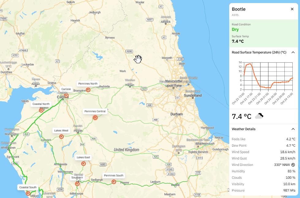
More efficient treatment using the OpenWeather Winter Road Maintenance Dashboard
OpenWeather provides Cumberland with a Winter Road Maintenance Dashboard and expert meteorological consultancy, enabling a shift from broad assumptions to targeted, route-level decisions. Duty teams can assess network conditions and drill into specific links, prioritising higher-risk areas, known cold spots and exposed sections.
Targeted decision-making reduces avoidable call-outs and lowers seasonal salt usage while maintaining safety. Efficiency is strengthened through consistent workflows that record shift activity: selected routes, key temperature and ice indicators (including sub-zero periods and minimum temperatures), treatment timing, spreading method and salt type. This reduces manual administration, removes fragmented notes and standardises reporting.
Treatment records can be automatically generated as clear PDF reports, supporting handovers, audits and post-event reviews without additional workload. Because actions are logged by route and salt type, depot stock levels update automatically.
Building a unique accuracy advantage: on-premise sensing and high-resolution feeds
To reduce uncertainty from sparse observation networks, OpenWeather is running proof-of-concepts to expand capture of on-premise and near-road conditions. These focus on temperature and surface heat dynamics, wind behaviour, precipitation, air quality and related climate signals. Developed with leading UK universities, including Imperial College London, the POCs strengthen scientific credibility and validation.
The goal is to deliver granular, high-resolution data feeds that better reflect conditions at road-link level – particularly where standard networks miss rapid changes, such as bridges, exposed corridors, valleys, coastal sections and dense urban areas.
This capability supports detailed heat island mapping around urban corridors and junctions, where small temperature differences can alter frost risk and treatment needs. It also captures wind and precipitation micro-variability on exposed routes – including gust-driven icing, drifting snow and rapid wet-to-freeze transitions – improving confidence in treatment timing and targeting.